|
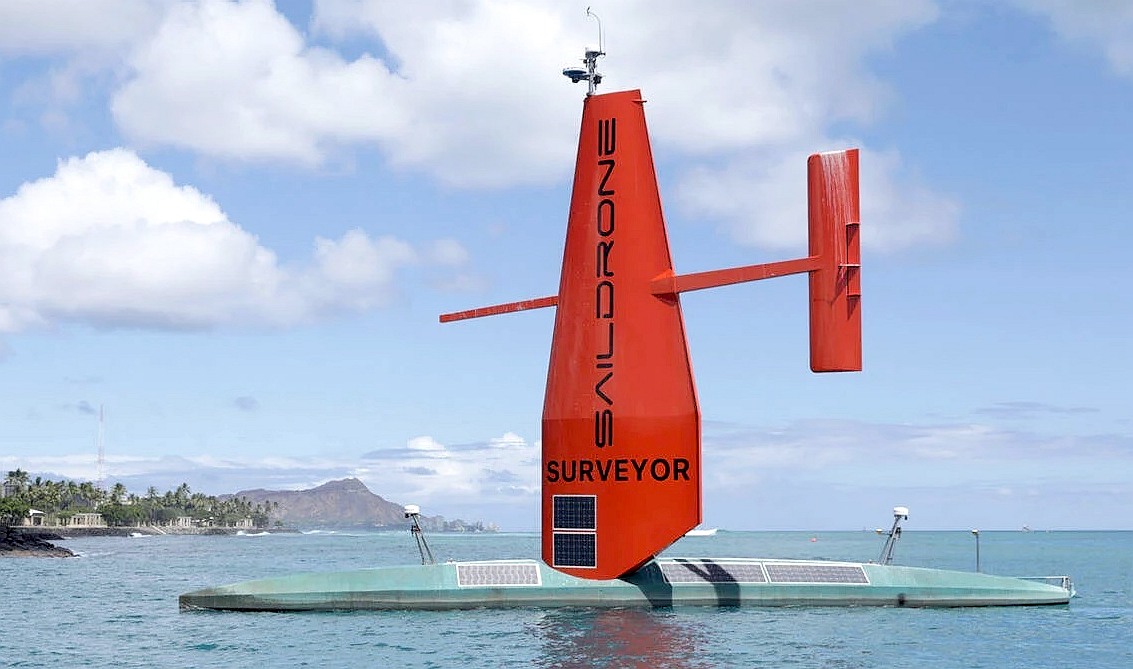
SAILDRONE
SURVEYOR
ABOUT -
CIRCUMNAVIGATION
- CONTACTS -
FOUNDATION -
HOME - A-Z INDEX
22M
SAILBOAT - The 72 foot Surveyor uses advanced AI algorithms
the learn, to navigate the seven seas unmanned.
THE REGISTER - 9 JULY 2021
The human-devoid AI-powered Saildrone Surveyor ship just made it to Hawaii from SF
28 days at sea alone with nothing to look at but the waves and ocean floor
A human-free autonomous boat known as the Saildrone Surveyor has successfully sailed from San Francisco to Hawaii to cross the Pacific Ocean while mapping the topography of the seabed, an achievement made less than a month after a similar
IBM-powered boat failed.
The Saildrone Surveyor, 22 metres long and and weighing 12,700 kilograms, sailed 2,250 nautical miles over 28 days to map 6,400 nautical miles of seafloor. The project is the largest attempt yet to map Earth's undersea landscape; we have mapped the Moon more than our planet's deep oceans.
The boat uses a 360o camera to record its surroundings. These images are then processed by GPUs running computer-vision neural networks to detect objects, Saildrone said.
There are several other types of sensors onboard, ranging from radar to infrared to navigate in the dark, and it is powered by wind and solar energy. Saildrone trained its machine-learning systems on data recorded from sailing journeys stretching a total of over 500,000 nautical miles across 13,000 days at sea.
“This successful maiden voyage marks a revolution in our ability to understand our planet,” CEO and founder Richard Jenkins, gushed in a statement. “We have solved the challenge of reliable long-range, large-payload remote maritime operations. Offshore survey can now be accomplished without a large ship and crew; this completely changes operational economics for our customers.”
Saildrone will now focus on expanding its fleet with the aim of mapping the entire ocean floor in ten years. But sea research isn’t all the company has its eyes on. Jenkins said he wants to expand Saildrone Surveyor’s technology to other industries including security and defense, too.
There are numerous ongoing projects to sail AI autonomous ships around the world.
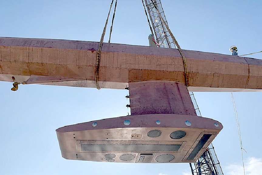
IBM’s Mayflower ship attempted an ambitious transatlantic trip from England to the US last month. Unfortunately, it only lasted three days at sea before it broke down and had to return home to get fixed.
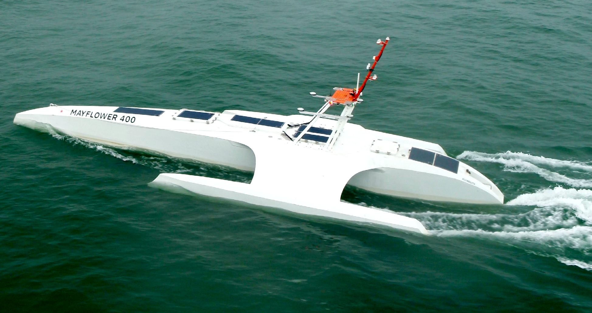
MAYFLOWER
SEA TRIALS 2020
- Kicking up quite a wash in moderate seas, indicates that the
hull is not as efficient as it might be, or that trim is off.
Worth looking at. Bow entry looks good.
Less than 20% of Earth’s oceans have been mapped using modern, high-resolution technology—we know more about the topography of the Moon and Mars than we do about our own planet. And yet, knowing the shape of the seabed is critical to understanding ocean circulation patterns, which affect climate and weather prediction, tides, wave action and tsunami wave propagation, sediment transport, underwater geo-hazards, and resource exploration. Saildrone is excited to announce it has launched the Saildrone Surveyor, a new 72-foot uncrewed surface vehicle (USV) equipped for high-resolution mapping of the ocean seafloor.
The Surveyor carries a sophisticated array of acoustic instruments for both shallow and deep-water ocean mapping; the Kongsberg EM 304 multibeam echo sounder is capable of mapping the seafloor down to 7,000 meters below the surface. The Surveyor also carries two state-of-the-art Acoustic Doppler Current Profilers (ADCPs), the Teledyne Pinnacle 45 kHz ADCP and the Simrad EC150-3C ADCP, to measure ocean currents and understand what is in the water column. The Surveyor is also equipped with the Simrad EK80 echo sounder for fish stock assessments.
The Saildrone Surveyor was developed in part through a public-private partnership with the University of New Hampshire (UNH) and the Monterey Bay Aquarium Research Institute (MBARI) to integrate and test sensors on the Saildrone Surveyor for mapping the seafloor and revealing life in the water column. While conducting ocean mapping missions, the Surveyor will collect samples of environmental DNA (eDNA) from the water
column - DNA originating from the sloughed-off skin, mucus, and excrement of a wide variety of marine
animals - which will reveal the genetic composition of organisms inhabiting the water. This PPP was supported by a three-year grant from the National Oceanic and Atmospheric Administration (NOAA) Office of Ocean Exploration and Research (OER) through the National Oceanographic Partnership Program (NOPP).
Saildrone’s fleet of USVs has logged more than 10,000 days at sea in some of the most extreme weather conditions on the planet. In 2020, Saildrone completed its first Arctic mapping mission on behalf of NOAA’s National Ocean Service, and in 2019, Saildrone completed the first autonomous circumnavigation of Antarctica, collecting critical carbon data related to climate science.
The launch of the Saildrone Surveyor coincides with the start of the United Nations Decade of Ocean Science for Sustainable Development and presents a paradigm shift in enhanced seabed mapping. Ocean mapping is currently done with very large and expensive crewed ships. The Saildrone Surveyor is a scaled-up version of the Saildrone Explorer, the 23-foot wind and solar-powered saildrone, which has been proven in numerous operational missions for science, ocean mapping, and maritime security, covering more than 500,000 nautical miles from the
Arctic to the Antarctic.
Like the Explorer, the Saildrone Surveyor is uncrewed and uses renewable solar energy to power its robust sensor suite; the Surveyor delivers an equivalent survey capability, but at a fraction of the cost and carbon footprint of a traditional survey ship and without putting human health and safety at risk.
“The launch of the Surveyor is a huge step up, not just for Saildrone’s data services but for the capabilities of uncrewed systems in our oceans,” said Richard Jenkins, founder & CEO of Saildrone. “For the first time, a scalable solution now exists to map our planet within our lifetime, at an affordable cost.”
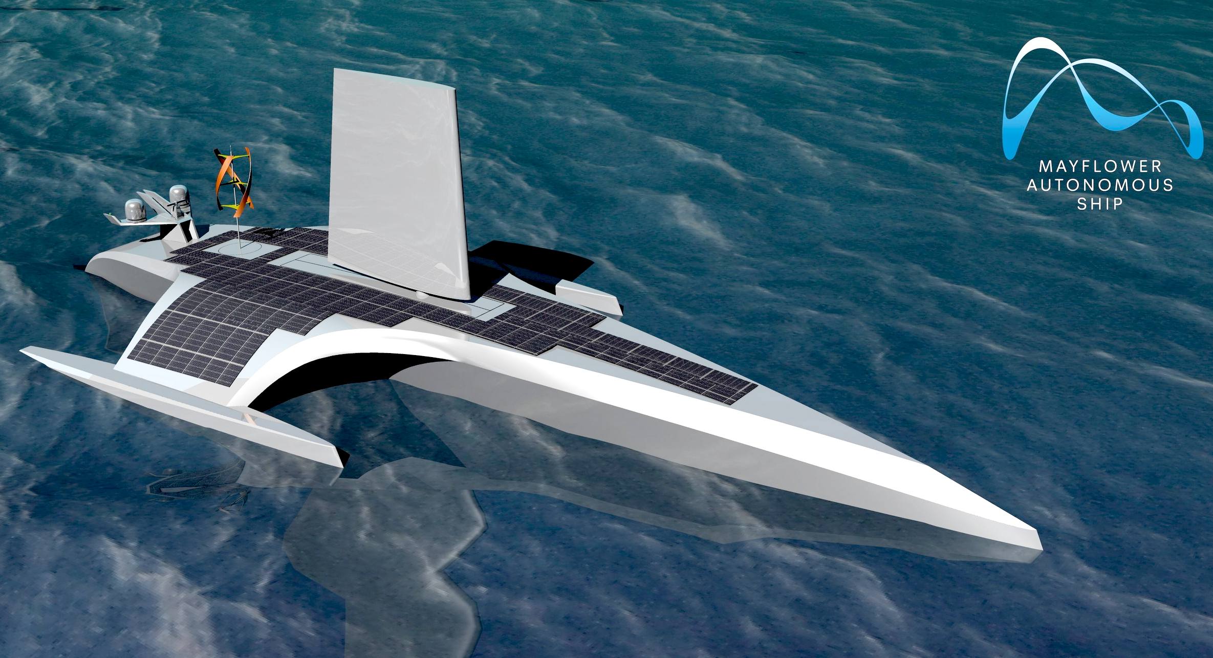
ORIGINAL
CONCEPT
- This was the Mayflower as originally proposed, showing a
foil sail, wind turbine and hull 100' in length, with
substantial solar panel deck area. The hull is now 50' and
there are no wind energy harvesting devices. But media
articles keep getting it wrong.
LINKS
& REFERENCE
https://www.theregister.com/2021/07/09/saildrone_surveyor_radar/
https://www.saildrone.com/news/saildrone-launches-72-foot-surveyor-ocean-mapping
https://www.theregister.com/2021/07/09/saildrone_surveyor_radar/
https://www.saildrone.com/news/saildrone-launches-72-foot-surveyor-ocean-mapping
This
website is provided on a free basis as a public information
service. Copyright © Cleaner
Oceans Foundation Ltd (COFL) (Company No: 4674774)
2021. Solar
Studios, BN271RF, United Kingdom.
COFL
is a charity without share capital.
|