|
THE
AEGEAN SEA
ABOUT - CLIMATE
CHANGE - COASTAL TOURISM
- CONTACTS - FOUNDATION -
HOME - OCEAN
PLASTIC - OCEANS
PLEASE
USE OUR A-Z INDEX
TO NAVIGATE THIS SITE
MAP
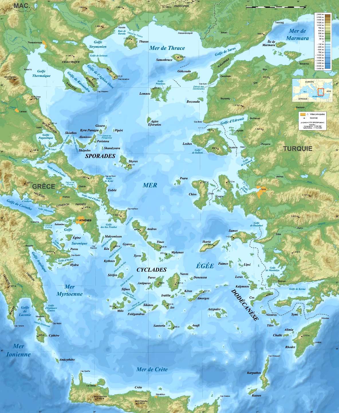
- This map shows the large number of
islands that need to be interconnected with boats that will
eventually need to be zero carbon.
The Aegean Sea is an elongated embayment of the Mediterranean Sea, and covers about 214,000 square kilometres (83,000 sq mi) in area, measuring about 670 kilometres (420 mi) longitudinally and 390 kilometres (240 mi) latitudinally.
The sea's maximum depth is 3,543 metres (11,624 ft), located at a point east of Crete. The Aegean Islands are found within its waters, with the following islands delimiting the sea on the south, generally from west to east: Kythera, Antikythera, Crete, Kasos, Karpathos and Rhodes. The Anatolian peninsula marks the eastern boundary of the sea, while the Greek mainland marks the west. Several seas are contained within the Aegean Sea; the Thracian Sea is a section of the Aegean located to the north, the Icarian Sea to the east, the Myrtoan Sea to the west, while the Sea of Crete is the southern section.
The Greek regions that border the sea, in alphabetical order, are Attica, Central Greece, Central Macedonia, Crete, Eastern Macedonia and Thrace, North Aegean, Peloponnese, South Aegean, and Thessaly. The historical region of Macedonia also borders the sea, to the north.
The Aegean Islands, which almost all belong to Greece, can be divided into seven groups:
- Northeastern Aegean Islands, which lie in the Thracian Sea
- East Aegean Islands (Euboea)
- Northern Sporades
- Cyclades
- Saronic Islands (or Argo-Saronic Islands)
- Dodecanese (or Southern Sporades)
- Crete
The word archipelago was originally applied specifically to the Aegean Sea and its islands. Many of the Aegean Islands, or chains of islands, are actually extensions of the mountains on the mainland. One chain extends across the sea to Chios, another extends across Euboea to Samos, and a third extends across the Peloponnese and Crete to Rhodes, dividing the Aegean from the Mediterranean.
The bays and gulfs of the Aegean beginning at the South and moving clockwise include on Crete, the Mirabello, Almyros, Souda and Chania bays or gulfs, on the mainland the Myrtoan Sea to the west with the Argolic Gulf, the Saronic Gulf northwestward, the Petalies Gulf which connects with the South Euboic Sea, the Pagasetic Gulf which connects with the North Euboic Sea, the Thermian Gulf northwestward, the Chalkidiki Peninsula including the Cassandra and the Singitic Gulfs, northward the Strymonian Gulf and the Gulf of Kavala and the rest are in Turkey; Saros Gulf, Edremit Gulf, Dikili Gulf, Gulf of Çandarlı, Gulf of İzmir, Gulf of Kuşadası, Gulf of Gökova, Güllük Gulf.
The Aegean sea is connected to the Sea of Marmara by the Dardenelles, also known from Classical Antiquity as the Hellespont. The Dardenelles are located to the northeast of the sea. It ultimately connects with the Black Sea through the Bosphoros strait, upon which lies the city of Istanbul. The Dardenelles and the Bosphoros are known as the Turkish Straits.
TOURISM
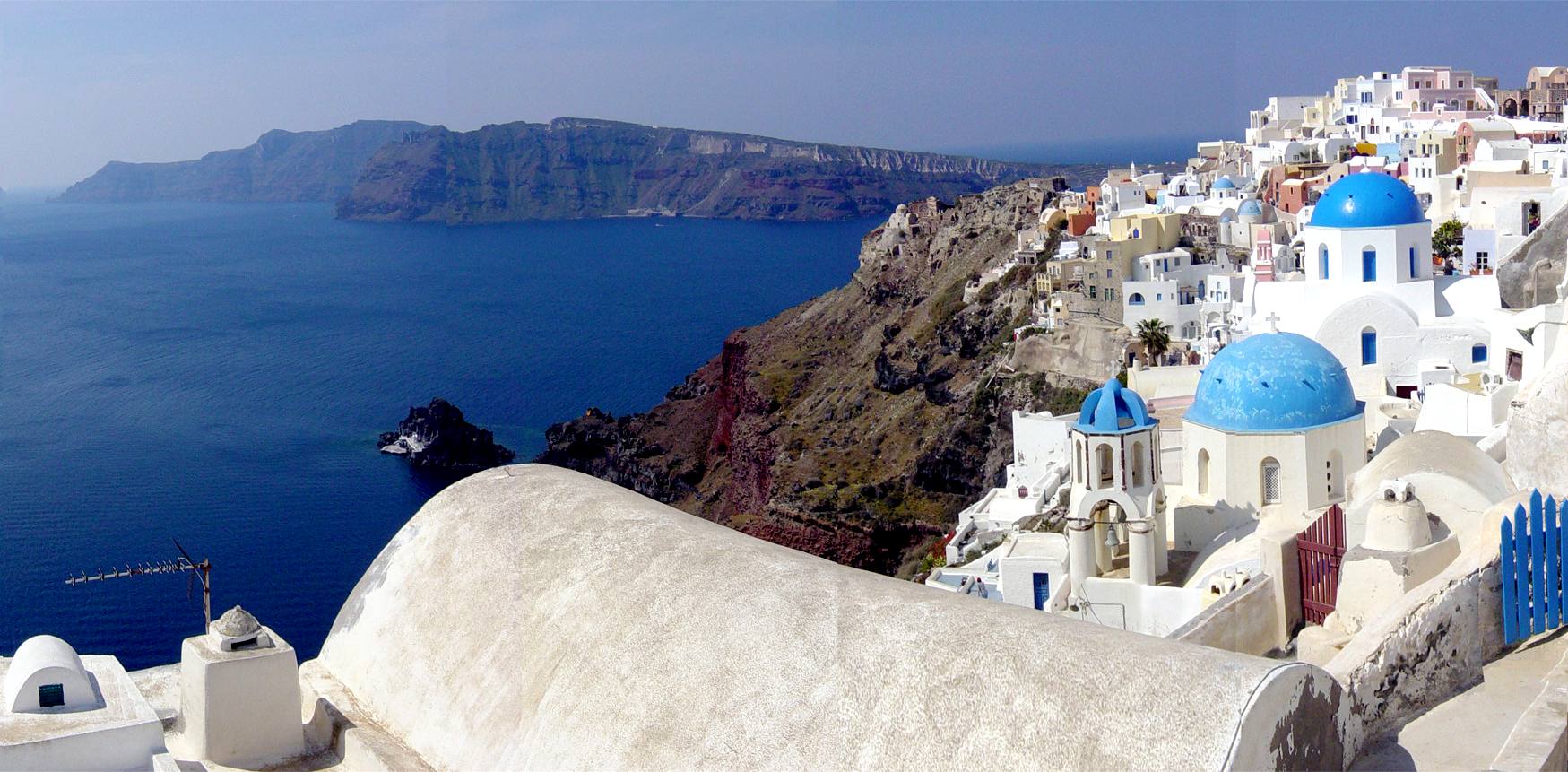
The Aegean islands within the Aegean Sea are significant tourist destinations. Tourism to the Aegean islands contribute a significant portion of tourism in Greece, especially since the second half of the 20th century. A total of five
UNESCO World Heritage sites are located the Aegean Islands; these include the Monastery of Saint John the Theologian and the Cave of the Apocalypse on Patmos, the Pythagoreion and Heraion of Samos in Samos, the Nea Moni of Chios, the island of Delos, and the Medieval City of Rhodes.
Greece is one of the most visited countries in Europe and the world with over 33 million visitors in 2018, and the tourism industry around a quarter of Greece's Gross Domestic Product. The islands of Santorini, Crete, Lesbos, Delos, and Mykonos are common tourist destinations. An estimated 2 million tourists visit Santorini annually. However, concerns relating to overtourism have arisen in recent years, such as issues of inadequate infrastructure and overcrowding. Alongside Greece, Turkey has also been successful in developing resort areas and attracting large number of tourists, contributing to tourism in Turkey. The phrase "Blue Cruise" refers to recreational voyages along the Turkish Riviera, including across the Aegean. The ancient city of Troy, a World Heritage Site, is on the Turkish coast of the Aegean.
Greece and Turkey both take part in the Blue Flag beach certification programme of the Foundation for Environmental Education. The certification is awarded for beaches and marinas meeting strict quality standards including environmental protection, water quality, safety and services criteria. As of 2015, the Blue Flag has been awarded to 395 beaches and 9 marinas in Greece. Southern Aegean beaches on the Turkish coast include Muğla, with 102 beaches awarded with the blue flag, along with İzmir and Aydın, who have 49 and 30 beaches awarded respectively.
Coastal Tourism is based on a unique resource combination at the border of land and sea environments: sun, water, beaches, outstanding scenic views, rich biological diversity (birds, whales, corals etc), sea food and good transportation infrastructure. Based on these resources, various profitable services have been developed in many coastal destinations such as well maintained beaches, diving, boat-trips, bird watching tours, restaurants or medical facilities.
TRANSPORT
Multiple ports are located along the Greek and Turkish coasts of the Aegean Sea. The port of Piraeus in Athens is the chief port in Greece, the largest passenger port in Europe and the third largest in the world, servicing about 20 million passengers annually. With a throughput of 1.4 million TEUs, Piraeus is placed among the top ten ports in container traffic in Europe and the top container port in the Eastern Mediterranean. Piraeus is also the commercial hub of Greek shipping. Piraeus bi-annually acts as the focus for a major shipping convention, known as Posidonia, which attracts maritime industry professionals from all over the world. Piraeus is currently Greece's third-busiest port in terms of tons of goods transported, behind Aghioi Theodoroi and Thessaloniki. The central port serves ferry routes to almost every island in the eastern portion of Greece, the island of Crete, the Cyclades, the Dodecanese, and much of the northern and the eastern Aegean Sea, while the western part of the port is used for cargo services.
The Port of Thessaloniki is the second-largest container port in Greece after the port of Piraeus. In 2007, the Port of Thessaloniki handled 14,373,245 tonnes of cargo and 222,824 TEU's, making it one of the busiest cargo ports in Greece and the second largest container port in the country. Paloukia, on the island of Salamis, is a major passenger port.
FISHING
Fishing is Greece's second largest agricultural export, and contains Europe’s largest fishing fleet. Fish captured include sardines, mackerel, grouper, grey mullets, sea bass, and seabream. There is a considerable difference between fish catches between the pelagic and demersal zones; with respect to pelagic fisheries, the catches from the northern, central and southern Aegean area groupings are dominated, respectively, by anchovy, horse mackerels, and boops. For demersal fisheries, the catches from the northern and southern Aegean area groupings are dominated by grey mullets and pickerel (Spicara smaris) respectively.
The industry has been impacted by the Great Recession. Overfishing and habitat destruction is also a concern, threatening grouper, and seabream populations, resulting in perhaps a 50% decline of fish catch. To address these concerns, Greek fishermen have been offered a compensation by the government. Although some species are defined as protected or threatened under EU legislation, several illegal species such as the molluscs Pinna nobilis, Charonia tritonis and Lithophaga lithophaga, can be bought in restaurants and fish markets around Greece.
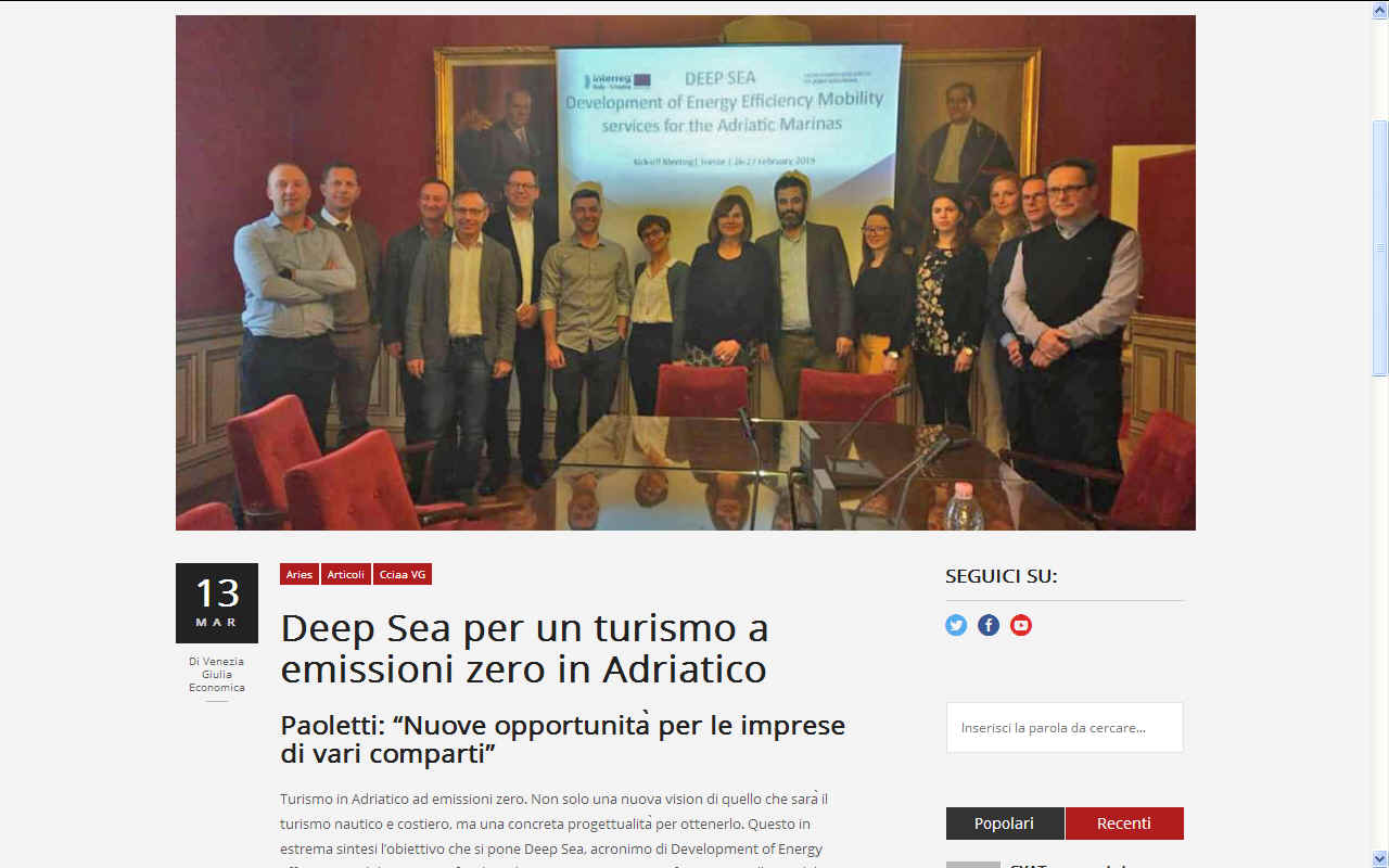
DEEP
SEA MARCH 2019 - Turismo in Adriatico ad emissioni zero. Non solo una nuova vision di quello che sarà il turismo nautico e
costiero, ma una concreta progettualità per ottenerlo. Questo in estrema sintesi l’obiettivo che si pone Deep Sea, acronimo di Development of Energy Efficiency mobility services for the Adriatic marinas, progetto finanziato nell’asse del Trasporto marittimo del Programma Interreg
Italia-Croazia e che ha preso avvio questa mattina a Trieste in Camera di Commercio Venezia Giulia con l’incontro operativo dei partner. Complessivamente il valore del progetto è pari a 2,5 milioni di euro
(durata gennaio 2019- 30 giugno 2021) e vede come leader partner Aries Scarl-Camera di Commercio Venezia
Giulia.
Mobilità elettrica abbinata a produzione di energie rinnovabili in modo da sviluppare una nautica sostenibile senza
emissioni, rumori, vibrazioni dove l’energia elettrica viene prodotta direttamente nelle Marine e utilizzata dalle
barche, per la mobilità dei turisti che raggiungono le banchine o le aree
attigue. Questi alcuni dei punti progettuali nel cui raggiungimento sono coinvolti Aries Camera di Commercio Venezia
Giulia, Università degli Studi di Trieste, Camera di Commercio di Foggia, Regione
Puglia, Comune di Andria per la parte italiana, mentre per la Croazia l’Autorità portuale di
Krk-Veglia, il Comune di Malinska Dubašnica, Rera-Agenzia per lo sviluppo della Regione
Spalato-Dalmatina, le Università di Rijeka-Fiume e Split-Spalato e il marina
H.L. Dvorac.
L’obiettivo è quello di dar vita sì a un turismo a basso impatto
ambientale, ma soprattutto a trasformarlo nel ‘brand di qualità e sostenibilità’ capace di contraddistinguere il mare l’Adriatico come un punto di riferimento e un esempio pilota in ambito non solo
europeo.
Dalla Puglia al Friuli Venezia Giulia, alle coste della Croazia: i partner progettuali hanno iniziato a lavorare assieme proprio per creare e promuovere un modello di mobilità sostenibile applicata alla nautica e al turismo costiero in
generale. Ovvero a quelle attività che si trovano a utilizzare energie rinnovabili e non più motori a scoppio
(endotermici). Propulsione elettrica coerente con un turismo verde e
sostenibile, rispettoso di parchi marini e terrestri in sintonia con lo sviluppo organico del
territorio.
“In questo percorso – ha commentato il presidente camerale Antonio Paoletti – verso l’ottenimento della qualità
turistico/ambientale ad emissioni zero potranno trovare nuove opportunità di investimento anche gli imprenditori nautici e della
cantieristica, gestori delle marine, albergatori e operatori del terziario più in generale che coglieranno le s de
produttive, le autorità politiche e istituzionali che andranno ad innovare l’aspetto normativo in funzione sempre più green, nonché i cittadini e le comunità che in questi territori vivono e lavorano e che in questo modo troveranno nuove e ulteriori opportunità
occupazionali. Va infatti sottolineato che un ruolo di particolare rilevanza lo avrà anche la mobilità verso l’interno, quella che abbinata all’attività nautico-costiera consentirà la visita delle città d’arte, dei siti archeologici e delle bellezze naturalistiche dei territori che si affacciano sull’Adriatico”.
PLASTIC PROBLEM
The accumulation of plastic on the beaches and in the marinas
of the countries bordering the Mediterranean
is a growing problem for tourism and tourists visiting these
otherwise amazing holiday destinations. Plastic pollution
potentially damages the economies of those affected as well as
poisoning the fish
that humans
eat.
-
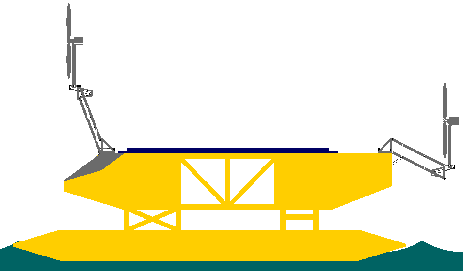
H2020
- Collaborative research proposal to develop rotary
sails in conjunction with other innovative advances as
a means to provide sustainable tourism and eventually,
world shipping with major disruption to ports and
harbours. Such development could benefit operators of ferry
and cruise services in Europe,
who might be looking for a way of continuing to enjoy economic
blue growth without adding to global
warming.
LINKS
& REFERENCE
https://
ABS
- ACID
OCEANS - BIOMAGNIFICATION
- BP DEEPWATER - CANCER
- CARRIER BAGS
- CLOTHING - COTTON BUDS - DDT
FISHING
NETS
-
FUKUSHIMA - MARINE LITTER
- MICROBEADS
- MICRO
PLASTICS - NYLON - OCEAN GYRES
- OCEAN WASTE
PACKAGING - PCBS
-
PET - PLASTIC
- PLASTICS
- POLYCARBONATE
- POLYSTYRENE
- POLYPROPYLENE - POLYTHENE - POPS
PVC - SHOES
- SINGLE USE
- STRAWS - WATER
ACIDIFICATION
- AEGEAN
- ADRIATIC
- AMBRACIAN
GULF
- ARCTIC
- ATLANTIC
- BALTIC
- BAY
BENGAL - BAY
BISCAY - BERING
- BLACK
- CAPE GOOD HOPE
CAPE
HORN - CARIBBEAN
- CASPIAN
- CORAL
- EAST
CHINA -
ENGLISH
CH - GULF
GUINEA - GULF
MEXICO - GUANABARA
BAY
- INDIAN
IONIAN - IRISH -
MEDITERRANEAN
- NORTH
SEA - PACIFIC
- PERSIAN
GULF - RED
- SEA
JAPAN - STH
CHINA - SEA
LEVEL RISE
SOUTHERN
OCEAN - TYRRHENIAN
GANGES
- NILE
This
website is provided on a free basis as a public information
service. copyright © Cleaner
Oceans Foundation Ltd (COFL) (Company No: 4674774)
2025. Solar
Studios, BN271RF, United Kingdom.
COFL
is a charity without share capital. The names Amphimax™
RiverVax™
and SeaVax™
are trademarks.
|